Walkable City Tours— made for detours

Most guides tell you what's there. This one tells you what's worth a detour.

Make a plan. Then don't follow it, on purpose.

Every city comes with one good walk, and forty reasons to wander off it.

Your phone already knows what's near you. What it can't tell you is why any of it is worth crossing the street for. This is forty-odd places in one city, each with a reason attached, ordered by how far away they really are on foot — and the schedule is entirely yours.

Pick a city

The bright ones are ready. Walk them, free, right now. The rest are a ballot: tap one and I'll count it. I build the ones people ask for, in the order they ask.

Free, no sign-in, no catch. Here's why →

Not every city qualifies. Most don't.

Walkability isn't a vibe, it's a test. Can you get between the good parts on foot, in an afternoon, without at some point wishing you'd just driven? Are the interesting things close enough together that wandering gets rewarded instead of punished?

Walkable

  • Québec City
  • Boston
  • Savannah
  • San Francisco
  • New Orleans

Not Walkable

  • Dallas
  • Columbuswhere I live
  • Houston
  • Phoenix
  • Orlando

The cities in the second column have plenty going for them. But in any of them I'd tell you to rent a car, and I'd be right. This is the wrong tool for about three quarters of the places you might go.

Help us decide which cities to do

Here is the actual thing, not a picture of it.

This is a live piece of the Québec City edition, running on this page. Three places ordered by how long they really take to reach, with one opened up. This is the live view — in the city it measures from wherever you are; before you get there, from your hotel.
Québec Citylive · on the plateau E
Starting from Hôtel Le CavalierChange
5 min10 min 20 minAll Raining D Hide seen Only wants G
4MINA
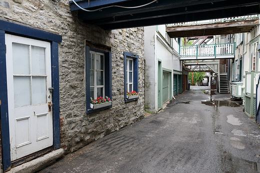
Rue Sous-le-Cap
Not a style. A condition. B
WanderPhoto ★★★down the cliff C
wantseen
14MIN
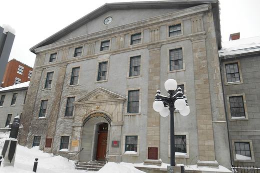
Morrin Centre
Prison, then college, then Victorian library — all one building.
HistoryArchitecture ★★★Closes in 40 min
wantseen
5MIN
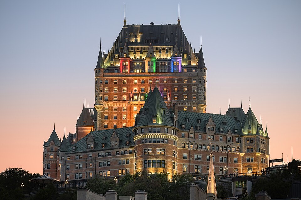
Château Frontenac
Not a French château. An 1892 American invention.
TouristArchitecture ★★
wantseenworth it?👍 👎
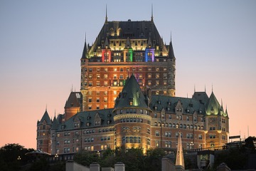
Château Frontenac at dusk
Photo: source and attribution

Designed by Bruce Price, an American architect, for the Canadian Pacific Railway. The whole point was to manufacture a romantic French identity for railway tourists — Loire Valley imagery, enormous steep roofs, turrets, a deliberately irregular skyline.

What to look for FA 19th-century North American interpretation of 15th-century France. Knowing that makes it far more interesting than knowing its construction date.
A

Minutes, not metres. The list reorders itself as you walk. Four minutes down to Sous-le-Cap, fourteen back up to the Morrin Centre — even though they are barely three hundred metres apart.

B

One line on why you'd care. Not a rating, not an opening time. The thing a friend who knows the city would say on the way over.

C

It tells you about the climb. This is the flag a radius circle can never show you, and in a cliff city it decides your whole afternoon.

D

Filter to the day you're having. Raining, so show me what's indoors. Ninety minutes left, so show me what's close and still open.

E

It knows whether you've arrived. While you're still planning, everything is measured from your hotel door — set the address once. Once you're actually in the city it switches to live GPS on its own and measures from wherever you're standing, reordering as you walk. No button to press.

F

What to look for. Written by someone who stood in front of it, for the two minutes you'll be standing in front of it.

G

Mark what you want. Not when you'll do it. Tap the heart on anything that catches your eye — at home, on the train, over breakfast — then filter to just those. A shortlist with no order attached. That's the plan half of make-a-plan-and-don't-follow-it.

The two-hour problem

You've got two days somewhere new. You did the research, made a list, maybe dropped pins on a map. Then you're standing on a corner at 3pm with ninety minutes before things close, and you have no idea what's near you that you actually care about.

You assume there's an app for this. There sort of is, and that's the problem: your map app knows everything and cares about nothing, so it'll happily send you eleven minutes out of your way to a gift shop. Reviews tell you a place is popular, not whether it's interesting. Your own list is in a doc you're not going to open.

So you walk toward the famous thing, because at least it's a decision. The part nobody has put in your pocket is the second layer — not what that building is, but why you'd cross the street for it.

What you get instead

Forty-odd places, each with a reason attached

Every entry answers "why would I go there" in a line, and opens into a real paragraph if you want it. What you're looking at, what to notice, what most people walk straight past.

Honest walking distance

Ordered by how far things really are, updating as you move. Hills and stairs count. In some cities that changes everything, and in the flat ones it costs you nothing.

Filters for the day you're actually having

Raining, so show me what's indoors. Ninety minutes left, so show me what's close and still open. Seen it already, so make it disappear. No schedule, no suggested route, no Day 1 and Day 2.

A shortlist, with no order attached

Heart the ones you care about before you go. Tick them off as you see them. What's left is the answer to "what do I still want that's near me" — which is the only question worth asking at three in the afternoon. No counter, no progress bar, nothing keeping score.

What "curated" means here

Two entries lifted straight out of the Québec edition, unedited.

Château Frontenac

Not a French château. An 1892 American invention.

Designed by Bruce Price, an American architect, for the Canadian Pacific Railway. The whole point was to manufacture a romantic French identity for railway tourists — Loire Valley imagery, enormous steep roofs, turrets, a deliberately irregular skyline.

What to look forA 19th-century North American interpretation of 15th-century France. Knowing that makes it far more interesting than knowing its construction date.

Filed under: the famous thing, with the reason it's famous

Place Royale

Champlain landed here in 1608. Almost nothing you see is from then.

Champlain built his Abitation on this spot in 1608 — fort, store, trading post and house in one — which is why this is called the cradle of French North America. Indigenous people had been using the shore long before that. A fire in 1682 took the lot, so the buildings around you are the rebuild; the square was the market place until 1686, when the intendant put a bust of Louis XIV in the middle and renamed it after the royal squares the king wanted in every province. Wolfe's guns flattened much of it again in 1759. Then in the 1960s and 70s the province restored the whole quarter toward a harmonised French Regime look rather than preserving every later alteration.

What to look forTwo things at once: the oldest concentration of 17th and 18th-century buildings in North America, and the 1960s idea of what they should have looked like. Restoration philosophy is a layer here. On the ground near the church, the outline of Champlain's second house is marked in the paving. The bust of Louis XIV is a 1931 replica, not the 1686 original. Worth seeing in daylight and again after dark.

Filed under: what you're actually looking at

The closest thing to this is paper.

There is no shortage of city guides, and most of them are better than this at something. VoiceMap will tell you a story in your ear for an hour. Google Maps will actually get you there. Atlas Obscura has thirty thousand places in it and this has forty-eight in one city. If what you want is a narrated route, go and buy a narrated route — they're good, and this isn't one.

The guides I keep going back to aren't apps at all. Blue Crow Media. Monocle. Wallpaper*. Edited down to what's actually worth your time, written by people who went there, and printed on something that imposes no order on your day. I'd rather be measured against those than against anything in an app store.

The one thing a printed map can't do is know where you're standing. It can't tell you that the place you're considering is fourteen minutes away because it's up a cliff, or that the thing you were about to walk past is four minutes downhill and closes at five.

That's the whole idea. The intelligence of a good printed guide, with the one thing paper can't have.

Questions

Is it really free?
Yes. Open a city, start walking. No account, no email, nothing to install. Every guide works offline once it's loaded. Mark the places you want to see, walk The Loop, or explore boldly — the experience is yours.
Will it always be free?
Honestly, we don't know yet, but here's our thinking. This site isn't anyone's rent money. Nobody's living off it, so there's no pressure to squeeze it. Our plan is to keep the city guides free and sign-in-free at least through the end of 2026, and then take an honest look. If we ever do charge for a guide, it'll be a small one-time amount — roughly what you'd tip a good tour guide — not a subscription. And if that day comes, you'll hear it from us well ahead of time.
So how does it pay for itself?
Right now it doesn't, and that's fine. Down the road we'd rather sell something worth paying for than charge for the basics: a printed or keepsake version of a city guide, maybe one built around the walk you actually took. If enough people want that, the guides themselves can stay free indefinitely. That's the outcome we're rooting for.
What if you disappear?
The guide you've loaded keeps working on your phone, and if you add it to your home screen, it stays there. We built it that way on purpose.
How does it work offline?
Open a city once on Wi-Fi and give it a minute. It quietly saves the whole guide to your phone, map and photos included, about 4 to 13 MB depending on the city, roughly the equivalent of a few photos from your phone’s camera. The guide itself saves first and the large photos follow in the background; you can watch it, or stop it, at the bottom of the page. After that it works with no signal at all, which matters because the places worth going are often the places with no bars. You can close it; it opens again without a connection. On an iPhone, add it to your home screen so Safari keeps it: open the city, tap Share, then Add to Home Screen. The one thing that needs a connection is looking up your hotel.
Is it an app?
No. It's a web page you add to your home screen. Nothing to install, no permissions beyond location.
Does it replace my map app?
No, and it isn't trying to. Every place hands off to Apple or Google Maps in one tap. This answers where to go; your map app answers how to get there.
How many places per city?
Between forty and fifty — deliberately more than you can do in a few days. You're meant to choose, not to finish.
Who makes these?
One person, by hand, in cities he's walked. Québec was built for a trip of my own; it worked well enough that I'm finding out whether anyone else wants one.